Andean Treks

Secret Trekking in Circuit north of the royal cordillera

Trek sauvage dans la partie nord de la Cordillère Royale agrémenté de l’ascension glaciaire du Chachacomani. Le trek de la partie nord de la Cordillère Royale est un très beau trek, sauvage et engagé, récompensé par des vues saisissantes sur les glaciers. Il s’adresse aux amoureux des grands espaces, ayant l’expérience des treks d’altitude exigeants et hors sentiers. Pour terminer en beauté ce magnifique trek, vous pourrez réaliser l’ascension du Chachacomani, un splendide massif glaciaire. Cette ascension n’est pas technique mais assez physique. Les vues sur la Cordillère Royale sont juste incroyables ! Un trekking Peak magnifique à ne pas rater !

Overview
  • Durée 6 jours
  • Transport private vehicle
  • Accompagnement English speaking trekking guide
  • Altitude 5.100 m asl
  • Période From May to October

Prix indicatif, hors vols internationaux. Toutes les nuits, repas, guides et transferts inclus.

Plan my trip
Jour 1

LA PAZ – LAGUNA CACHA (4637 M .A.S.L./15213 FEET) - LAGUNA CHOJÑA QUTA (4745 M.A.S.L./ 15565 FEET)

  • Départ 8:00 am
  • Hébergement tent
  • Repas lunch, dinner
  • Transport 4/5h

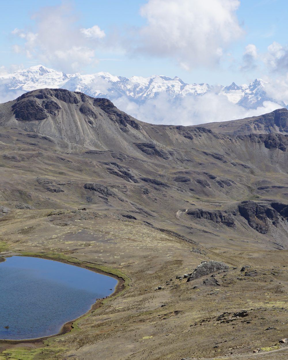
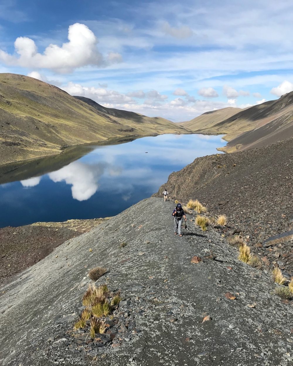
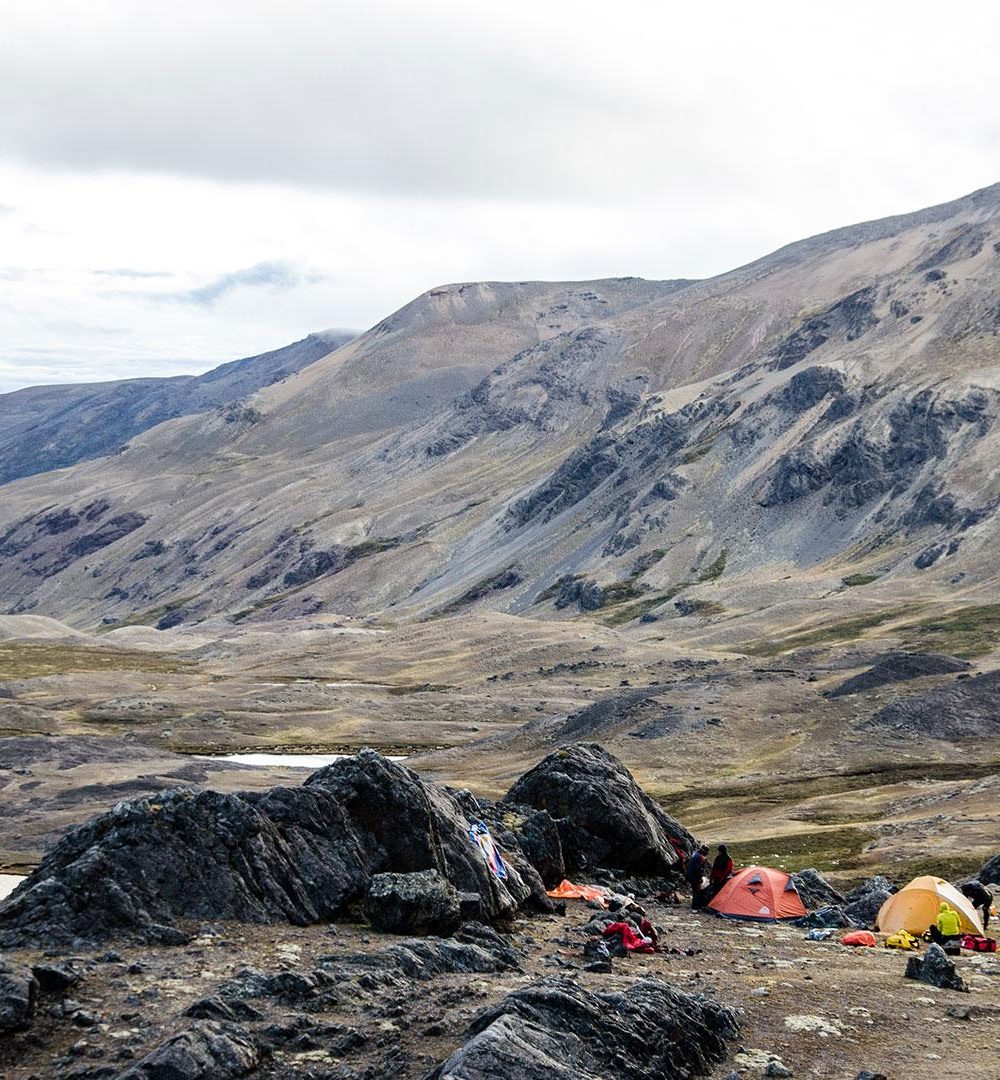
Transfer by 4x4 vehicle to Laguna Cacha (4637 m.a.s.l./15213 feet). From Cacha Lake, we go up, on foot (on the left) or 4x4 (on the right), the small lake valley that stretches northeast to the pass (or paso) Calzada ( 5,050 m.a.s.l./16568 feet ). On the route, we discover Ajoyan Lake ( 4,665 m.a.s.l./15305 feet) first, then further on, two magnificent turquoise blue lakes: Chojña Khota (4,722 m.a.s.l./15492 feet ) and Carizal ( 4,767 m.a.s.l./15639 feet). Camp on the shores of Chojña Khota Lake, at the foot of the Kasiri and Calzada glaciers which cover the slopes of the homonymous mountains. Recently, the development of a track has made it possible to access a 4x4, not far from the shores of Chojña Khota Lake. This alternative is less tiring but less interesting. Up to you…

Jour 2

LAGUNA CHOJNA QUTA - LAGUNA JISTAÑA QUTA (4560 meters / 14 960 feet a.s.l)

  • Départ 10:00 am
  • Hébergement tent
  • Repas breakfast, lunch, dinner
  • Marche / vélo 3/4h

In the morning you can choose either to relax in the sun around the lake, or climb up to the Calzada Pass to the Carizal Lake. In this case, we follow the shoreline towards the north-east up to the Calzada Pass (5050 m.a.s.l. / 16 568 feet asl.), nestled between the Kasiri and Calzada Massifs. We descend by the same route to Chojña Khota. After lunch, we head out towards the south to Lake Jistaña. We cross a pass at 5100 m.a.s.l. / 16 732 feet asl and descend through the valley to the lake.

Jour 3

LAGUNA JISTAÑA QUTA (4560 M.A.S.L./14960 FEET) - LAGUNA CHISCACALLIUANI (4820 M.A.S.L. / 15813 FEET )

  • Départ 8:00 am
  • Hébergement tent
  • Repas breakfast, lunch, dinner
  • Marche / vélo 7h

We hike to Chiscacalliuani Lake. Our day’s trek takes us west across the mountain and south to Niquioyo Khota Lake (4672 m.a.s.l./ 15 328 feet ). We see the Condor Jipina (5 315 m.a.s.l. / 17 437 feet ) in the foreground. We follow a ridge towards the south-west that offers an amazing panorama of the Altiplano and Lake Titicaca. We continue across 2 passes, the first at (4950 m.a.s.l./16 240 feet ) and the second at 5000 m.a.s.l. ( 16 404 feet ), descending through a steep scree to the green waters of Chiscacalliuani Lake.

Jour 4

LAGUNA CHISCACALLIUANI (4820 M.A.S.L./15813 FEET) - RIO CHACHA KUMANI – BASE CAMP CHACHACOMANI (4470 M.A.S.L./14665 FEET) – CHACHACOMANI HIGH CAMP (5130 M.A.S.L./16830 FEET)

  • Départ 7:00 am
  • Hébergement tent
  • Repas breakfast, lunch, dinner
  • Marche / vélo 6/7h

Departure on a mountainside due south to reach the Chacha Kumani valley (4 430 m.a.s.l./14534 feet): it is a wide marshy valley which leads to the foot of the imposing glacial massif of the same name. We go northeast to the bottom of the valley to reach the Chachacomani massif. The clear view on the coveted summit. We need to find the best path in the bofedals (marshy area dotted with giant mosses soaked in water) to reach the stream that winds on the other side of the valley, then cross it. We arrive at the foot of a valley which sinks northwest below the Chachacomani. Then, we head northwest towards the perpendicular valley. We quickly gain height. We arrive in a pretty valley wound by a stream (4700m.a.s.l./15419 feet). We continue to the bottom around (4775 m.a.s.l./ 15666 feet) before going up on a very steep slope due north. We then attack this ultimate climb in rocky chaos. We arrive at the edge of the glacier. The place is magic to establish the camp (5130m.a.s.l./16830 feet ).

Jour 5

ASCENT OF CHACHACOMANI (6074 m.a.s.l./ 19 927 feet) - BASE CAMP (4470 m.a.s.l. / 14 665 feet)

  • Départ 1:00 am
  • Hébergement tent
  • Repas breakfast, lunch, dinner
  • Marche / vélo 9/10h

We depart in the night and make our way across the glacier to fissured plateau. We pass around crevasses to the foot of the Chachacomani ridges. As we head east to the main summit, the slopes are steeper (45º). The view from the summit ridge is stunning, stretching from the north to the south of the Cordillera. We descend by the same route and return to base camp.

Jour 6

BASE CAMP CHACHACOMANI (4470 m.a.s.l./ 14 665 feet) - CRUZ PAMPA (4420 m.a.s.l./ 14 501 feet) - LA PAZ (3600 m.a.s.l./ 11 811 feet)

  • Départ 8:00 am
  • Hébergement none
  • Repas lunch, dinner
  • Transport 3h
  • Marche / vélo 2h

Return to the village of Cruz Pampa and drive to La Paz.

Also worth a look

Other itineraries you might enjoy

Like this itinerary?

Reach out to adjust this itinerary to your pace,
your level, your wishes.

Plan my trip