Mountains & Ascents

Pomerape Ascent

The Pomerape volcano is the twin of the better known volcano, the Parinacota, located in the Cordillera Occidental, in the Sajama National Park. The Pomerape nevertheless deserves to be known, as much for its varied and more technical ascent as for the incredible views it offers on neighboring volcanoes, and in particular the crater of Parinacota. We offer its ascent in south-north crossing, which offers a more interesting glacial race with the last 150 meters below the summit inclined at 60º. A varied and somewhat technical ascent, which changes a bit from the classic “volcanoes”. A beautiful atmosphere not to be missed.

Overview
  • Duration 2 days
  • Transport private vehicle
  • Site fees Included
  • Guide IFMGA english speaking guide (subject to availibity)
  • Altitude from 3.600 to 6.222 m asl
  • Best time From May to October

Indicative price, excluding international flights. All nights, meals, guides and transfers included.

Plan my trip
Main stops
  • A volcano ascent varied and technical.
  • Breathtaking view on the Parinacota crater.
  • Unforgettable crossing of this magnificent volcano.
Day 1

LA PAZ - SAJAMA - PARINACOTA/POMERAPE BASE CAMP ( 5135 M.A.S.L./16850 FEE

  • Start 07:00 am
  • Accommodation tent
  • Meals lunch, dinner
  • Transport 4h
  • Walk / Bike 1h

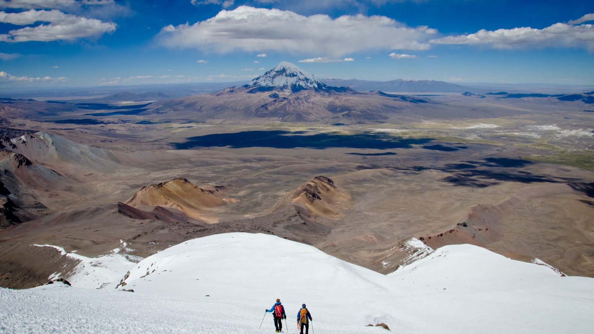
Departure in the morning for the crossing the Altiplano. From Sajama village: transfer in 4WD vehicle to the place called Inkamarka (4995 m.a.s.l./16380 feet). Approach march to the foot of Parinacota volcano ( 5135 m.a.s.l./16850 feet). Night at the base camp (It is also possible to go the base camp with the 4WD vehicle).

Day 2

POMERAPE CROSSING ASCENT (ALT. 6222 M ALT.) - HOT SPRINGS - SAJAMA ( 4250 M.A.S.L./13940 FEET) – LA PAZ (3600 M.A.S.L./11811FEET)

  • Start 01:00 am
  • Accommodation none
  • Meals breakfast, lunch
  • Transport 4h
  • Walk / Bike 14/16h

Ascent without technical difficulty, but long and physically demanding, with some steep sections (AD/II).Departure in the night (Around 1 am). Climb in the rocks, on the volcano side until the edge of the glacier. Long march on the ridges until we reach a flat area after 4 to 5 hours walk from base camp. Then the slopes become steeper on the ridge, the last one being 55º/60º on 150 m. We’re left with walking on the summit ridges before reaching the main peak.10 to 11 hours ascending from the base camp. Possibility to descend by the same route or by the other side, which is technically easier. Long descent on the ridges of the east-face (Around 4 to 5 hours). Back to our vehicle, and drive to the spring waters to have a very well deserved relaxing bath.Back to Sajama with our vehicle. Return to La Paz. Arrival by end of the day.

Also worth a look

Other itineraries you might enjoy

Like this itinerary?

Reach out to adjust this itinerary to your pace,
your level, your wishes.

Plan my trip